


'Sterrenkaart van de zuidelijke sterrenhemel'
Vintage Illustrations of Stars and Celestial Maps
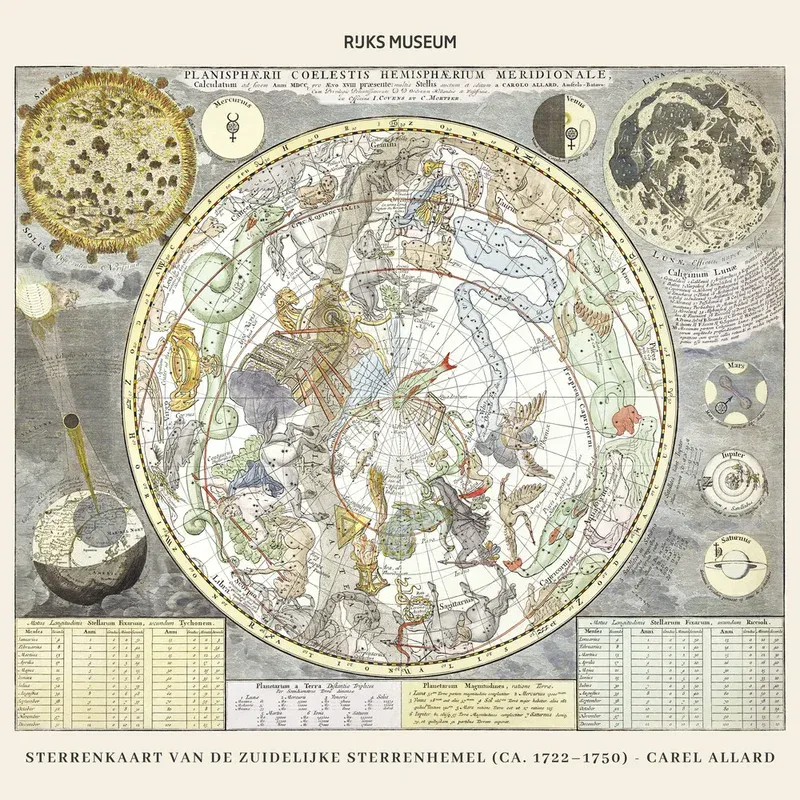
This charming illustration features the "Sterrenkaart van de zuidelijke sterrenhemel," a historical star map by Carel Allard from around 1722 to 1750. In soft beige and silver tones, the design evokes a sense of nostalgia and discovery. The intricate details and artistic composition invite you to immerse yourself in the world of astronomy and antique maps. This illustration is perfect for a quiet reading nook or as a focal point in an office.
Inviting Art for Relaxation Spaces
This celestial map brings a harmonious atmosphere to your home, blending vintage charm with a modern touch.
The illustration is also available in other formats, including high-quality prints on acrylic glass, aluminum dibond, or as fine art prints. If you're unsure about the product selection, we are happy to provide personal advice.
Country: Netherlands
Artist's description:
Sterrenkaart van de zuidelijke sterrenhemel (ca. 1722–1750) by Carel Allard, original from The Rijksmuseum
Collections: Designs & Illustrations, Vintage, City plans & world maps


